
Southampton archaeologists towed ground-penetrating radar across Old Sarum, north of Salisbury, and mapped walls 3.5m thick, churches, houses, roads and cesspits, along with structures in the cathedral precinct that pre-date the medieval cathedral
Ground-penetrating radar towed across Old Sarum in 2025 and 2026 has mapped walls 3.5m thick, churches, houses, roads and cesspits, Southampton says.
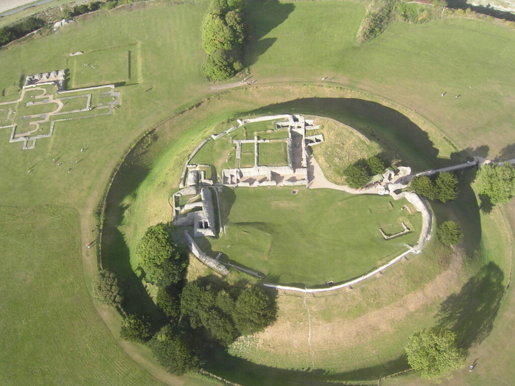
Staff and students from the University of Southampton’s Department of Archaeology have mapped the medieval centre of Old Sarum, north of Salisbury, with ground-penetrating radar, recording “defensive buildings with walls 3.5m thick, churches, houses, roads and infrastructure including cesspits”, the university’s Faculty of Arts and Humanities said on 6 November.
The radar seasons ran in the summers of 2025 and 2026 as part of a broader project at the site. They were designed to map, at high resolution, a city occupied in the 12th and 13th centuries. Earlier seasons of the same project had already covered more than 150 hectares using magnetometry and earth resistance.
Dominic Barker and Kristian Strutt, who directed the survey, said the results exceeded expectations and showed earlier phases of activity on the site, including “possible Roman remains”.
Eight channels towed by an all-terrain vehicle
The survey used an eight-channel ground-penetrating radar system towed by an all-terrain vehicle and positioned with GPS. The antennae ran at 450MHz and measured to a depth of over 3m, with readings recorded at a resolution of 0.1m by 0.03m.
Ground-penetrating radar sends pulses into the ground and records the signals that return from buried material. Walls, floors, ditch fills and voids reflect those pulses differently from the soil around them, so a dense grid of readings can be assembled into plans of buried structures and streets without excavation.
A resolution of 0.1m by 0.03m means readings spaced in centimetres rather than metres, close enough to separate individual wall lines from the ground between them. The GPS ties each radar trace to a coordinate, so the passes made across the site can be joined into a single plan.
Results from the south-west quadrant point to an extensive settlement area with residential buildings, a substantial high-status structure and infrastructure including possible drains and cesspits, the faculty said. The directors credited the dry summers of 2025 and 2026 with helping the survey show the city “in fine detail, down to individual structures and smaller features including courtyards and cesspits”.
The published results include defensive buildings with walls 3.5m thick, churches, houses and roads, together with infrastructure including cesspits. The faculty said Old Sarum’s changing fortunes had provided “an opportunity to map a major medieval city that had been abandoned”.
Structures older than the cathedral
The north-west quadrant of the site, the cathedral precinct, was excavated in part in the early 20th century. The radar survey shows structures associated with the cathedral and, in the faculty’s words, “a series of structures that pre-date the medieval cathedral, suggesting possible early medieval or Roman origins”.
No date has been attached to those earlier structures. Early medieval or Roman origins are set out as a possibility rather than a finding, and the survey directors used the same wording in referring to possible Roman remains among the earlier phases of activity.
Radar records the shape, depth and position of buried features. It does not date them, and establishing when the earlier structures were built would need excavation or dating evidence from the deposits themselves.
From Norman stronghold to abandoned city
From 1068 the site was important in establishing Norman power. By the 12th and 13th centuries Old Sarum was a defended site with a cathedral and a settlement around it, the city that the radar has now mapped at high resolution.
By the 13th century a new cathedral had been founded to the south, and Old Sarum was slowly abandoned in favour of Salisbury. Its churches, houses and roads were left to fall out of use and survive as buried deposits rather than standing buildings.
Old Sarum sits in the Avon valley in a landscape of multi-period sites, including the Portway Roman road, and the faculty describes it as “situated at the nexus of the Roman road network”. It is one of the historic sites around Wiltshire.
The faculty described the radar work as part of a broader project at Old Sarum, following the magnetometry and earth resistance surveys of earlier seasons. The directors said the 2025 and 2026 results exceeded what the team had expected to find.