Our National Cycle Network celebrates its 20th anniversary
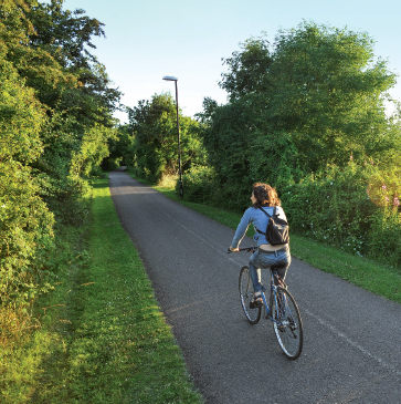
Britain’s National Cycle Network started life exactly 20 years ago and it has since grown to become more than 14,000 miles of sign-posted cycling paths stretching from the toe of Cornwall to the tip of the Scottish Highlands and crossing every type of landscape in between.
[caption id="BritainsBestonTwoWheels_img1" align="aligncenter" width="762"]

VISIT WALES
Some routes have been purpose-built for cycling, others share existing roads and lanes, but perhaps the most interesting are those that have breathed new life into the old and disused transport networks of the past. Railway lines that famously fell under the Beeching Axe in the 1960s, canal towpaths that once shuttled limestone, coal and iron across the country, and Cornish tramways that traversed the old tin and copper mines have been repurposed as cycling routes—and they offer an extraordinary glimpse into Britain’s rich history.
With so many miles of routes available, the hardest part is choosing which ones to tackle. So, here are some suggestions for the most scenic, historic and memorable rides in the country. Each one is numbered and sign-posted, so you’ll be able to follow them by looking out for the signs as you ride.
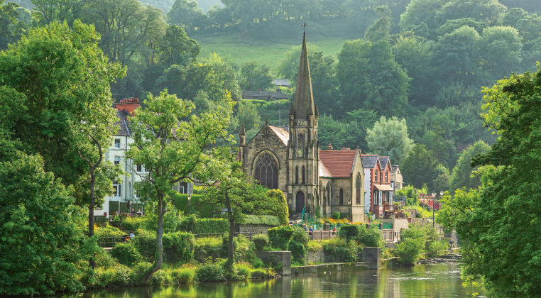
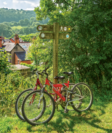
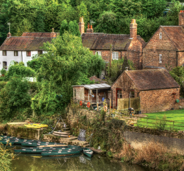
LLANGOLLEN CANAL, NORTH WALES (9.5 MILES)
START: Horseshoe Falls, Llantysilio FINISH: Chirk
ROUTE NUMBERS: 84 and 85
CYCLE HIRE: Hire Cycles 2 Go, Trevor Basin
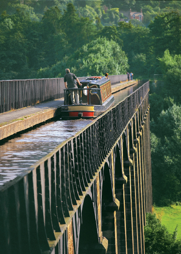
This ride follows one of the most scenic stretches of canal in the country across the picturesque Dee Valley. Horseshoe Falls is a pretty start. Then you’ll follow the towpath between the River Dee and Llangollen Canal against a backdrop of the Llantysilio Mountains. The pretty little town of Llangollen appears after just two miles and is a great place to pause, particularly in July during its famous International Eisteddfod. The raised aspect of the canal gives great views over the town, and as you continue onwards you’ll spot the remains of Llangollen’s medieval Castell Dinas Bran on the hilltop and the dramatic limestone ridge of The Panorama. Pontcysyllte Aqueduct’s 19 tall arches can be glimpsed a few miles later as you approach Trevor Basin. The basin buzzes with visitors all eager to cross one of the world’s highest navigable aqueducts, known as “the stream in the sky” and designed by great civil engineer Thomas Telford more than 200 years ago. You’ll have to dismount here and push across, enjoying giddying glimpses down to the River Dee 126 feet below. Once over the aqueduct you’ll be heading to the beautiful Ceiriog Valley, and you will ride beneath the shade of woodland before entering Whitehouse Tunnel (it’s sensible to dismount and push through). Just over a mile later you’ll reach Chirk train station where the ride ends, or you could continue for a very short distance to visit another of Thomas Telford’s masterpieces, Chirk Aqueduct.
[caption id="BritainsBestonTwoWheels_img2" align="aligncenter" width="369"]
VISIT WALES
[caption id="BritainsBestonTwoWheels_img3" align="aligncenter" width="370"]
VISIT WALES
SILKIN WAY, SHROPSHIRE (7 MILES)
START: Telford Town Park FINISH: Ironbridge
ROUTE NUMBERS: 45 and 55
CYCLE HIRE: Telford Cycle Centre
Ironbridge is recognised as the birthplace of the industrial revolution in Britain, but this ride also shows off the tremendous natural beauty of this World Heritage Site. Start at the cycle center in Telford Town Park and follow the signed trail through the park. You’ll pass the edges of Hinkshay Meadow in the opening miles, before passing the old platform of Dawley and Stirchley station, a relic from when this route was a working railway line. After just three miles, you’ll reach Blists Hill Victorian Town, where it’s worth pausing to get a taste of life in England as it was more than 100 years ago. Alternatively, simply carry on to Coalport where the benches overlooking the River Severn make a peaceful place to picnic. Cross the river on pretty Coalport Bridge, and you’ll find yourself on the Severn Valley Way riding into the thick woodland of Ironbridge Gorge. Valley views glimmer through the trees and the trail soon passes through Jackfield, where beautiful St. Mary’s Church and the elegant plum-coloured building of Jackfield Tile Museum are great photo opportunities.
Less than a mile later, the ride reaches a magnificent climax by taking you over the world’s first ever iron bridge. The pretty town seems to be suspended in time, with handsome, historic buildings climbing the hillside. You could end here, or continue along the river for a few minutes to the Museum of the Gorge, which reveals the industrial history of Ironbridge.
[caption id="BritainsBestonTwoWheels_img4" align="aligncenter" width="370"]
STEVE PASKIN
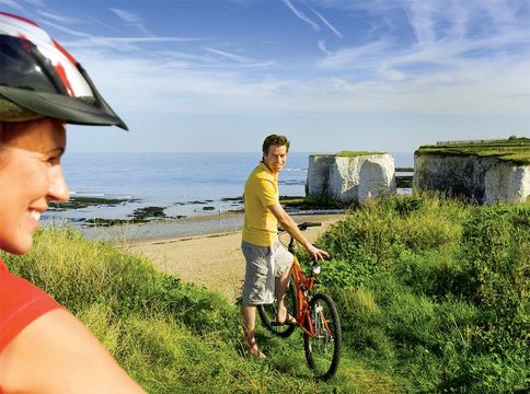
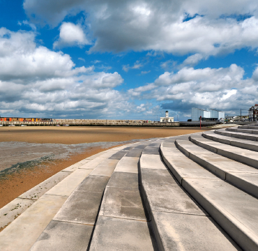
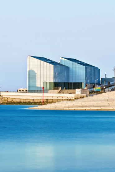
VIKING COASTAL TRAIL, KENT (9 MILES)
START: Reculver Country Park FINISH: Margate seafront
ROUTE NUMBER: 15
CYCLE HIRE: Viking Coastal Trail Cycle Hire, Minnis Bay This trail follows the sweeping Thanet coastline of northeast Kent, where Vikings first landed in Britain. Start at Reculver Country Park and ride eastwards on a wild and remote ride along the top of the northern sea wall. Look out for wading birds like oystercatchers across the foreshore, and cormorants stretching their wings.
Civilization returns around three miles in at Minnis Bay, one of many beautiful golden bays along this route. Here you’ll find traditional seaside cafés, ice-cream kiosks and a long stretch of sand, where you’ll surely be tempted to peel off shoes and socks and take a mid-ride paddle.
It’s a pleasant ride from Minnis Bay between the curves of the white chalk cliffs to Birchington-on-Sea and Epple Bay, before you tackle a short cobbled climb upwards to a great viewpoint and picnic spot on the grassy clifftop.
Dropping down again to reach sandy Westgate and St. Mildred’s bays, you cross Westbrook Undercliffe Nature Park, a promenade area of wildflowers and coastal wildlife. The lively seaside resort of Margate soon appears, and it’s an effortless ride along the seafront to end at Turner Contemporary, an art gallery inspired by romantic painter J.M.W. Turner. Leave time to soak up the renowned views over the vast sea and sky here; Turner himself described the skies over Thanet as “the loveliest in all Europe.”
[caption id="BritainsBestonTwoWheels_img5" align="aligncenter" width="370"]
VISIT KENT
[caption id="BritainsBestonTwoWheels_img6" align="aligncenter" width="370"]
VISIT ENGLAND/ALEX HARE
[caption id="BritainsBestonTwoWheels_img7" align="aligncenter" width="367"]
SUSTRANS
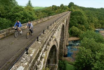
SOUTH TYNE TRAIL, NORTHUMBERLAND (5.5 MILES OR 10 MILES)
START: Haltwhistle FINISH: Lambley Viaduct or Slaggyford
ROUTE NUMBER: 68
CYCLE HIRE: Edens Lawn Cycle Hire, Haltwhistle
Haltwhistle, where this trail starts, is hailed as the geographical “Centre of Britain” (see British Heritage, March 2015, p. 24) and there are visible remains of Hadrian’s Wall, the country’s greatest Roman monument, to the north of the town if you fancy exploring the Wall before setting off.
“The journey is every bit as pleasurable as the destination”
[caption id="BritainsBestonTwoWheels_img8" align="aligncenter" width="434"]
J. BEWLEY/SUSTRANS
[caption id="BritainsBestonTwoWheels_img9" align="aligncenter" width="400"]
DANA HUNTLEY
Head south from Haltwhistle train station, immediately crossing over the River Tyne and look eastward to see the beautiful curves of Alston Arches, a viaduct spanning the water downstream. The remote and wild sheep-grazed hills of the North Pennines soon begin to appear. Look out for curlews in summer, recognizable by their elegantly curved beaks and haunting call.
This open scenery is eventually replaced by deep woodland and the high-sided cutting of the former railway as you head towards Coanwood Station. Here you need to make a choice about your onward journey. For a shorter and easier ride follow South Tyne Trail through the trees to magnificent 9-arch Lambley Viaduct. The views across the valley and river are breathtaking from the top of the viaduct, but there’s no access from the far end so you’ll have to retrace your route back.
Alternatively, at Coanwood Station join the road through Lambley village and ride around the viaduct. There are some steeper gradients here, but the views from the top of the hill are magnificent, and the viaduct itself can be spotted poking out from between the trees. The final miles are easy, passing beneath the trees of Softley Low Wood and crossing a smaller viaduct at Burnstones before ending at Slaggyford’s old railway station.
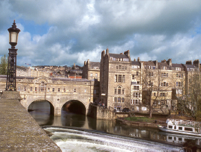
BRISTOL AND BATH RAILWAY PATH, SOMERSET (16.5 MILES)
START: Castle Park, Bristol FINISH: Bath
ROUTE NUMBER: 4
CYCLE HIRE: Bristol Cycle Shack
This was one of the first routes to be created on the National Cycle Network. Start at Castle Park and follow Route 4 signs out of the city center to the railway path. It’s a gentle climb to begin with, and you’ll enter the dark depths of Staple Hill Tunnel on the way to Mangotsfield Junction. The triangle of old train tracks here is where Carson’s Chocolate Factory once stood, one of many chocolate factories that existed in Bristol during its confectionary heyday. The climb steadily continues, before an effortless, sweeping descent leads you to the old Warmley Station and a delightful tea room. A little further along the path, look out for Gaius Sentius, a giant sculpture of a Roman. It marks the path’s halfway point and the site of a Roman Road.
In the second half of your journey you’ll follow the tracks of the steam-powered Avon Valley Railway for a short way before crossing the River Avon several times as it wriggles its way to Bath. Soak up the expansive views from these river crossings before entering the thick woodland of Kelston Park. The railway path ends just short of Bath city center. The final miles follow the banks of the river; then the signs will direct you right into the heart of beautiful Georgian Bath.


Comments