Walking the Footpaths
[caption id="TheCountrysideTraveler_img1" align="aligncenter" width="1024"]

JIM HARGAN
[caption id="TheCountrysideTraveler_img2" align="aligncenter" width="1024"]
JIM HARGAN
THERE’SSOMETHING YOU CAN DO in the British countryside that’s illegal almost everyplace in America: You can walk in it.
While North America has gargantuan tracts of wild land that are publicly owned and open to all comers, virtually all of its farmland is closed to walkers. What’s more, any attempt to see America’s countryside from anywhere other than a public road is likely to lead to a close encounter with a deputy sheriff. That’s why exploring the English landscape is such a unique pleasure. You can delve deep into the countryside, not just along the roads, but also across farmlands and fields. And this isn’t limited to a few famous hiking trails; it’s possible nearly everywhere.
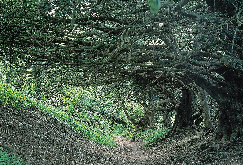
England has a dense network of public footpaths, with trailheads in every village and along every lane. It’s nearly impossible to find a part of the English countryside that is more than a mile from at least one of these footpaths. They are usually blazed on the ground, and always clearly and accurately indicated on inexpensive high-detail maps available from the local post office shop or bookseller.
Where did these paths come from? A thousand years ago, most of the English lived in villages surrounded by giant open fields. Every morning, farmers would walk from their huts across the fields to the various strips of arable and grazing land assigned to them. Of course, they couldn’t trample on their neighbors’ crops as they walked or drove their animals; instead, they had to follow set routes. These field paths became rights of way, routes along which people and their animals had a right to travel. A few such rights of way would evolve into roads, such as the ones that Queen Eleanor’s funeral procession followed in 1290 (see “Eleanor’s Crosses,” P. 40). Others would simply disappear, unneeded in the modern era.
Many of these rights of way (and others established over the years) have nevertheless survived into the 21st century, to become popular recreation routes. Urged on by organized walkers’ groups, Parliament has long protected the rights of way, and required that they be mapped and marked. With crowds, cars and cash more abundant than ever before, these rural pathways have become a central travel focus for much of Britain’s urban population. Yet there are so many miles of paths that you can walk all day and never see anyone.
How do you use this wonderful travel resource? First, you need a map. The British government’s Ordnance Survey publishes two series of maps that show the rights of way. For a brief exploration, the Landranger Series displays all roads, tracks, trails, farm buildings, pubs and rights of way with 1.25 inches to the mile, covering all of Great Britain in 204 sheets. For a deeper expedition into the countryside you need the Explorer Series maps, where a mile stretches over 2.5 inches, and you can get some serious detail; 470 very large sheets cover the island.
These maps can generally be found in a bookstore and in many village post of®ce stores, with merchants displaying an OS (Ordnance Survey) sticker on their doors. You can also order them over the Web, at www.ordnancesurvey.co.uk.
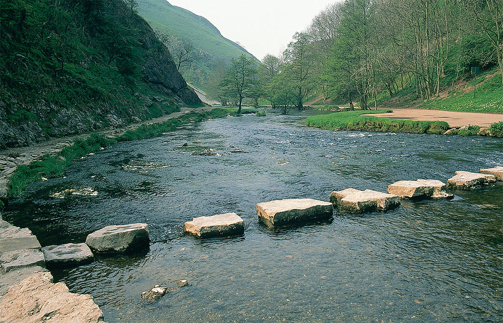
With map in hand, you are ready to hit the trail. The first thing you should know is that the right of way is just that—a yard-wide right to walk, and not necessarily a maintained trail. If it passes over growing crops, walk right over them, staying on the path. However, you can leave the path to walk around obstructions, which definitely include bulls. Should you accidentally stray from the trail, be assured that trespassing is not a criminal violation; the worst that can happen is that a landowner asks you to leave. However, straying shouldn’t be a problem. There should always be a stile or gate at every fence or hedge, so just aim from one stile to the next. You may have to share the path with cattle and sheep, and this can turn the trail into a muddy mess. The English nearly always wear their wellies on paths and trails for this reason.
To reduce difficulties on your maiden walk, aim for way-marked paths—paths that have been formally marked as recreation routes that actually start somewhere and go somewhere. There are three types of these. The most important are the national paths, created by an act of Parliament and maintained by the Countryside Agency, Britain’s equivalent of the U.S. National Park Service. They are always clearly blazed with an acorn symbol, and you can get good-quality guides (www.nationaltrail.co.uk). Second in importance are trails that have been way-marked by county councils—a vast network, crisscrossing every conceivable corner of the countryside. These have at some time in the past been blazed on the ground, but their maintenance and documentation vary considerably. The third, and least reliable, are those declared by local organizations, or even individual enthusiasts. As these lack county council approval, they will not be blazed on the ground, and you will have to rely solely on the locally published guidebook.
[caption id="TheCountrysideTraveler_img3" align="aligncenter" width="574"]
JIM HARGAN
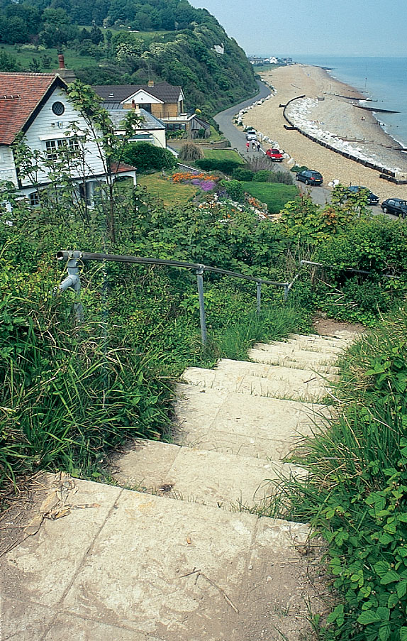
Countryside walkers now have even more places to ramble. Under the recent Countryside Right of Way (CRoW) Act, the public has the right to roam freely over open mountains, downs, heath lands and common areas (including land owned by Madonna, who tried and failed to block the CroW Act).
This new right of open access is being phased in as fast as maps can be prepared, with access throughout England and Wales expected by January 2006. To exercise this right you will need the latest edition of the local Explorer Series map, which will indicate open areas and access points. The Countryside Agency has the details (including maps) on a dedicated Web site, www.countrysideaccess.gov.uk.
For more information on walking in Britain, the Rambler’s Association maintains exhaustive information on Britain’s footpaths. See www.ramblers.org.uk


Comments