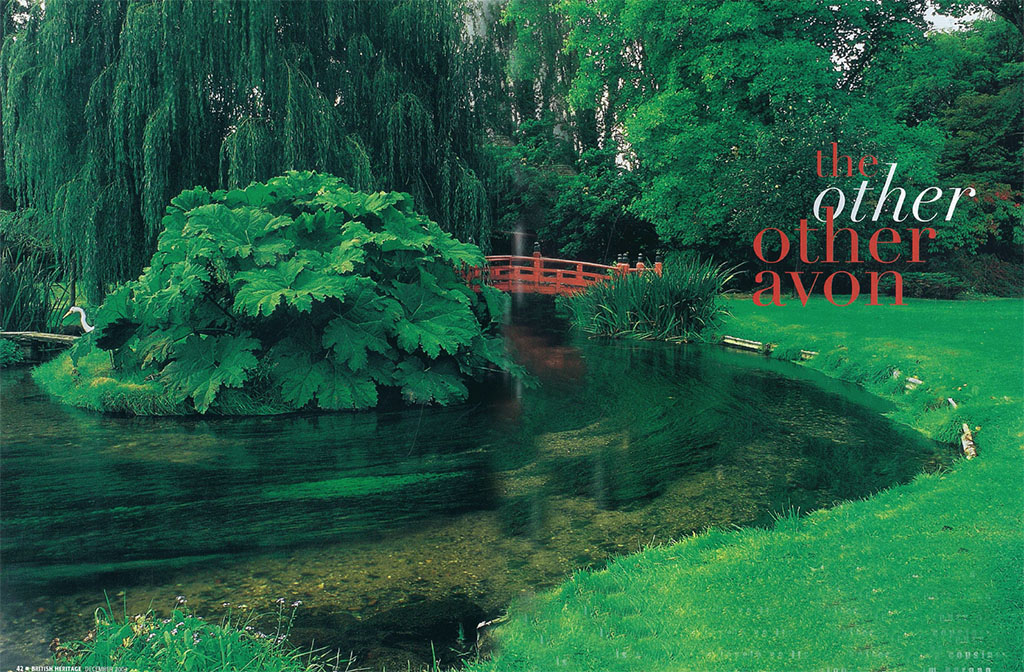
the salisbury avon is at least as lovely as its two better-known cousins.
[caption id="TheOtherOtherAvon_Feature" align="aligncenter" width="1024"]

[caption id="TheOtherOtherAvon_img1" align="aligncenter" width="366"]
eVERYONE HAS HEARD OF THE RIVER Avon — the one Shakespeare knew as a boy, the one Strat-ford is on. Then there’s the other well-known River Avon, forming Bristol’s mighty harbour and giving Bath much of its beauty. Much less celebrated is the third major River Avon, flowing south through the chalk downs of Salisbury—the other “other Avon.” It’s a wide, clear stream, flowing over gravel, lined by trees and meadows, a cluster of thatched cottages every few miles along its bank, and the
lonely chalk hills of Wessex looming above. And it has its share of major sites, particularly Salisbury Cathedral and Stonehenge. However, people just don’t consider visiting the river itself, or touring along its banks from village to village—and this makes the Salisbury Avon particularly nice.
Nor do these three rivers exhaust the list of Great Britain’s Avons. Four more minor streams (one in Devon and three in Scotland) are named “River Avon” or “Avon Water.” In all of these cases, “Avon” is simply an anglicized form of the Celtic word for “river.” This is a fairly common way of naming something; an invader, using hand gestures, asks the name of a feature, and a local replies (speaking slowly and loudly, no doubt) “THAT IS A RIVER.” In this way Saxon invaders named their newly conquered streams “The River River” not once, but seven times.
[caption id="TheOtherOtherAvon_img2" align="aligncenter" width="842"]
[caption id="TheOtherOtherAvon_img3" align="aligncenter" width="676"]
The Salisbury Avon rises in the centre of Wiltshire’s extensive chalk downs, 75 miles west of London, in a wide, flat-bottomed valley known as the Vale of Pewsey. From there it flows due south, cutting straight through the middle of Salisbury Plain, forming a long, thin ribbon of rich valley in this desolate upland and passing just beneath Stonehenge. As it continues downstream it passes the pre-Roman hillfort of Old Sarum, then the tall medieval spire of Salisbury Cathedral. Below Salisbury the Avon passes a series of villages before emptying into the English Channel at the town of Christchurch. In all, the Salisbury Avon stretches for 45 miles.
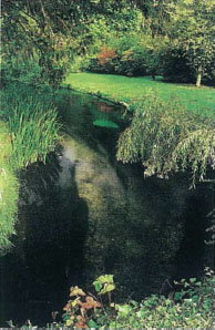
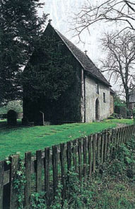
to FIND THE START OF THE SALISBURY AVON, visit the tiny twin villages of Alton Barnes and Alton Priors in the heart of the Vale of Pewsey. This odd little place received its schizophrenic identity in late Saxon times, when it was split between two powerful monasteries along the Avon headwaters. On the south side of this boundary sits the Alton Barnes parish church, a wonderful Saxon structure preserved almost without change from the time of King Alfred. Follow the footpath behind the Saxon church to a tiny spring-fed stream, clear and sandy-bottomed, and lined with trees—the head of the River Avon. From here you can stroll to Alton Priors’ 14th-century chapel, elaborately medieval in the full Decorated style, only 100 yards away. It’s surrounded by meadows with a small grouping of thatched cottages at the far end; to the right runs the ancient track called the Ridgeway, dating from the 4th millennium BC. A group of prehistoric monuments guards the chalk escarpment that looms 500 feet above the village—clearly visible from the Alton Priors Church Meadows, and with an 18th-century chalk carving of a horse.
[caption id="TheOtherOtherAvon_img4" align="aligncenter" width="192"]
[caption id="TheOtherOtherAvon_img5" align="aligncenter" width="194"]
[caption id="TheOtherOtherAvon_img6" align="aligncenter" width="191"]
[caption id="TheOtherOtherAvon_img7" align="aligncenter" width="678"]
This headwater stream no longer flows to the Salisbury Avon. Instead, it feeds the Kennet and Avon Canal, built in 1810 to link London and Bristol. A half-mile walk south from Alton Priors brings you to this fully operational and exceptionally beautiful canal, lively with the long, narrow, brightly painted canal boats now popular in England as watery RVs. This section of the Kennet and Avon, known as the “Long Pound,” goes for 15 miles on a dead level, and its towpath makes for some of the easiest, most scenic walking anywhere. Three miles to your right lies the village of Wilcot, with thatched cottages grouped around a green, and a truly wonderful village local, the Golden Swan. Half a mile to the left is the canal wharf of Honeystreet (named after the muddy condition of the Ridge-way in medieval times) and the canal-side Barge Inn, both dating to the earliest days of the canal. By the way, the Kennet and Avon Canal is named not for the Salisbury Avon, but for the Bristol/Bath Avon—here only 16 miles to the west.
[caption id="TheOtherOtherAvon_img8" align="aligncenter" width="190"]
[caption id="TheOtherOtherAvon_img9" align="aligncenter" width="192"]
[caption id="TheOtherOtherAvon_img10" align="aligncenter" width="186"]
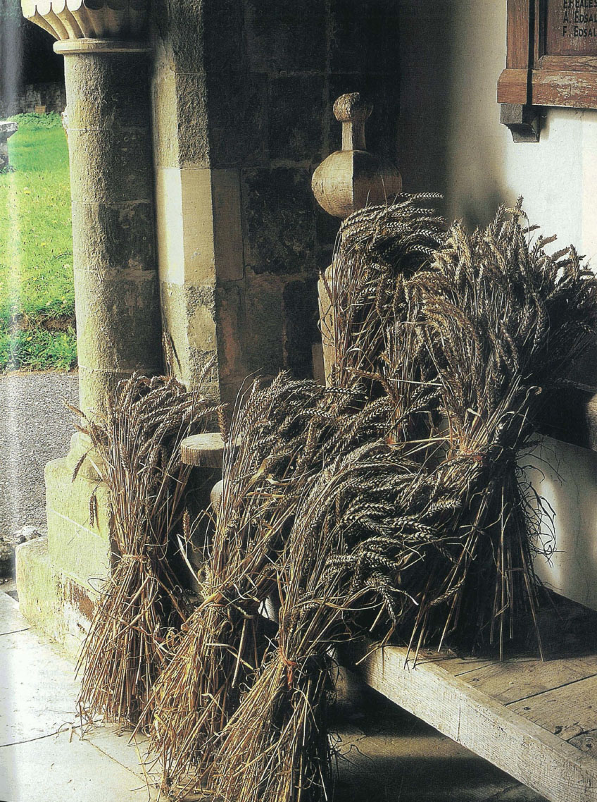
‘village england is a land of thatching and half-timbering, of tidy gardens that overflow with blossoms, of red phone boxes and post office shops.’
[caption id="TheOtherOtherAvon_img11" align="aligncenter" width="215"]
The Salisbury Avon’s various headwater streams flow together at the south edge of the Vale of Pewsey to form something that actually looks like a river—albeit a small one. From here the Avon slices through the Salisbury Plain, cutting a thin ribbon of a valley a quarter-mile wide, ten miles long, and 600 feet below the surrounding hills, ending at the congested town of Amesbury. Since World War I, this corridor has furnished the only public access through a gigantic agglomeration of airfields, training bases, artillery ranges, army camps, and a huge tank practice range. Enormous tank ramps cross the public roads every few miles.
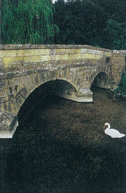
rIVERSIDE SCENERY PICKS UP AGAIN as the Avon flows south of Amesbury. An 18th-century arched bridge, built of golden stone, carries a lane out of the busy town centre and into the countryside downstream. To the right stretches the huge Stonehenge World Heritage Site, preserving 450 prehistoric monuments in addition to the famous stone circle. You may have been disappointed by a past visit to Stonehenge. Indeed, it’s been described as “a national disgrace …ugly setting and inadequate facilities…stranglehold of roads and traffic…” —and that’s by the people who run it, on its official website. This is quickly changing. Managing agencies are removing the highways, the ugly modern development, and the fences, replacing them with the sort of empty wild grasslands that greeted the invading Romans. Hopefully, by the time you visit, your downstream drive along the River Avon will be bordered by native downs grasslands that stretch up to Stonehenge and beyond.
[caption id="TheOtherOtherAvon_img12" align="aligncenter" width="848"]
Journey Notes
[caption id="TheOtherOtherAvon_img13" align="aligncenter" width="563"]
Heale House Gardens is in Middle Woodford, five miles north of Salisbury. Hours: daily except Monday, 10 am-5 pm. Admission: £3.65 adults. Tel: 01722 782 504.
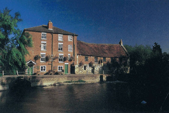
Harnham Mill/The Old Mill Hotel has a pub and restaurant featuring stylish English cuisine from fresh local ingredients. Or you can get a pot of tea or a pint of local ale, sit outside, and admire the ducks and swans. Tel: 01722 327517.
Braemore House, an impressive Elizabethan country house, is half a mile west of the A338 south of Salisbury and is well signposted. Hours: Apr-Sep 2.30-5.30 pm, with open days varying by month. The Braemore Countryside Museum is open 1-5.30 pm on the same days. Tel: 01722 512233.
The Museum of Electricity, in Christchurch, lies two blocks north of the town centre on the B3073. Sponsored by Scottish and Southern Energy pic, it’s staffed by volunteers, many of them retired electrical workers who really know their stuff. Hours: weekdays, Easter-Sep, noon-4.30 pm. Admission: £2 adults, £1.50 seniors, 50p children. Tel: 01202 480467.
Place Mill, a restored and operational Saxon Mill at the mouth of the Avon, is in Christchurch, just south of the town centre’s High Street at the end of the town harbour. With free admission, it has a display of milling artefacts, local art, and a gift shop. Hours: daily jun-Sep, 10 am-5 pm. Tel: 01202 487626.
Christchurch Priory Church is a must-see for anyone who values beautiful architecture. Hours: daily (subject to church services) 10 am-5 pm (2.15-5 pm on Sundays). Tel: 01202 485804; email: [email protected]; web: www.resortguide.co.uk/Christchurch-Priory.
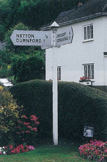
From here southward, the River Avon traverses the heart of Village England. This is a land of thatching and half-timbering, of tidy gardens that overflow with blossoms, of red phone boxes and Post Office shops. This is the part of England where the village local has been doing business for five centuries out of the same thatched inn, and will serve you locally brewed cask ale at its riverside picnic tables. The village names reflect their ancient riverside functions—Wilsford cum Lake, Durnsford, the Woodfords (Upper, Middle, and Lower), and Stratford-sub-Castle. Stratford marks the point where four Roman roads (“streets” in the Saxon language) converged by the Avon. The enormous Celtic hillfort of Old Sarum is the “castle” that still crowns the hill above the village.
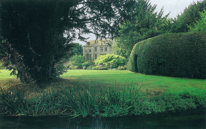
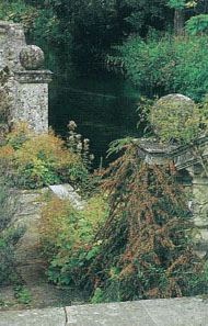
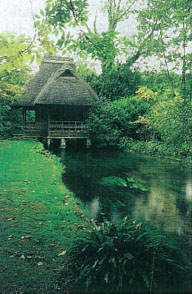
IN THE WOODFORDS YOU WILL FIND one of the great delights of Village England—the ancient manor house with open gardens. Here it’s Heale House, an attractive 16th-century brick manor in a loop of the River Avon, surrounded by eight acres of immaculate gardens. Formal terraces stretch out from the house, while informal and romantic gardens follow the Avon. A remarkable set of tunnels occupies one side terrace—tunnels formed from apple and pear trees with their branches trained to arch and entangle overhead. The Japanese Garden, laid out by an early 20th-century diplomat to Japan, is now a water garden with a network of canals and ponds; its imported tea house sits astride the Avon. Just outside the garden is a lovely and thorough-going nursery selling the fine English ornamentals featured in the gardens—a wonderful frustration for American gardeners, who can take neither plants nor seeds back through U.S. Customs.
[caption id="TheOtherOtherAvon_img14" align="aligncenter" width="182"]
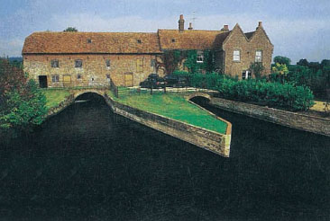
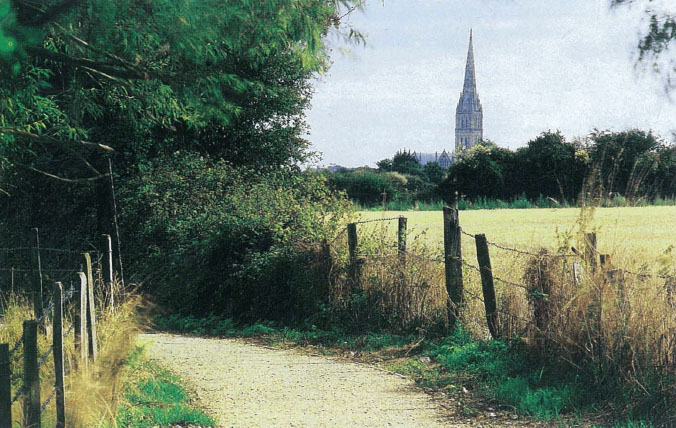
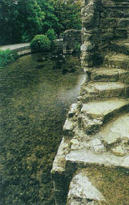
The bishop who built Salisbury in 1215 purposely routed the River Avon through the centre of town in a series of t canals to supply water power for mills. Many of the mills are still there, converted to other uses. One of the prettiest and oldest, dating from the founding of the town, sits at its southern edge—the Harnham Mill, now the Old Mill Hotel. You can drive to it, but the best approach for a river lover is to start at the Elizabethan Park (just west of downtown Salisbury) and walk south on the public footpath that crosses the Avon’s water meadows. An afternoon stroll will provide you with brilliantly illuminated views of medieval Salisbury and the great spire of its cathedral. The mill, a fine old brick building now eight centuries old, sits on the River Nadder just upstream from the Avon, across a weir footbridge.
Five large tributaries feed the Avon in and around Salisbury, and it swells to a good-sized river surrounded by wide meadows. As it becomes increasingly hard to ford or bridge, the villages along its edge become larger and farther apart. It passes through seven miles of remote, village-free countryside before it reaches its next crossing at Downton, a large, busy village with a collection of restored old mills and a Norman motte converted to a public garden. Another six miles leads to Fordingbridge, a small town with a lively historic centre across from its five-arch Norman bridge. Six more miles brings you to Ringwood, a large and busy town. River walkers can enjoy this long, rural stretch of the Avon by following the clearly waymarked Avon Valley Path, which delves deep into the countryside along and around the river.
OLD SARUM
Read about Salisbury’s ancient fortress in the March 2003 issue, available to order on the Back Issues page of BritishHeritage.com
Between Downton and Fordingbridge a narrow lane crosses the Avon on an 18th-century brick bridge, by an old mill that’s now a private residence. To the east, the open heath-lands of the New Forest National Park climb upward from river bluffs. To the west side sits Braemore, a beautifully preserved village where thatched cottages face a large green. Its grand 16th-century country house, emparked in the classic manner, has been home to the same noble family for the last quarter millennium; here you can see fine art, period furniture, tapestries, and antiques. In a beautiful Saxon church adjacent to the house, a recent restoration has revealed medieval wall paintings. Between the house and the village the Braemore Countryside Museum recreates the richness of village life at the beginning of the 20th century.
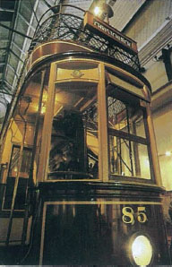
tHE FINAL STRETCH OF THE AVON passes two sites, very close together in space but far apart in time. St. Catherine’s Hill preserves a ridge of ancient heathland on the west edge of the Avon, with wide views eastward across the river to the New Forest. A mile south, the Museum of Electricity fills an early 20th-century power station (not a hundred feet from the river) with the largest collection of electrical gizmos in England—everything from early toasters to a full-size electric double-decker trolley.
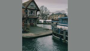
The Avon ends at the small city of Christchurch on the English Channel, where it merges with the River Stour to form Christchurch Harbour. Although modern Christchurch is now a part of the sprawling Bournemouth urban complex, its medieval centre remains a vibrant little downtown filled with historic buildings. Here, Christchurch gives the Avon a fitting climax. At the east end of the town’s centre, a medieval stone bridge crosses a wide millrace and the River Avon in a series of stone arches. On the west side stand the remains of Christchurch Castle, once a great stone fortification. A landscaped path leads downstream between the river and the millrace to a thousand-year-old mill, fully restored and in working order. To the right stands the cathedral-sized Christchurch Priory, a spectacular Norman-Gothic structure still in use as the parish church. Directly in front lies Christchurch Harbour, cheerful with sailing yachts, at the mouth of the Avon.


Comments