Unspoiled English countryside a short drive south of London story and photography by Jim Hargan
[caption id="TheSouthDowns_Feature" align="aligncenter" width="600"]


[caption id="TheSouthDowns_img1" align="aligncenter" width="439"]

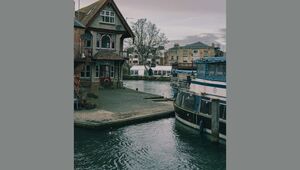
the as you explore the south downs way these river gorges fostered trade as well as castles.
fastest way out of London is south. Drive only 20 miles south of London’s Gatwick Airport, or 50 miles south of its bigger brother Heathrow, and you enter a land where narrow lanes, lined by wildflowers, wind by thatched cottages. Your view across a field may reveal a tiny village clustered around a church spire, or sheep grazing by a stone barn. Behind all these views loom tall chalk hills, wild and empty looking, crowned by grasslands and old forests. A scant hour’s drive south from the noise and smog of the airport, you are surrounded by mile after mile of unspoiled rural England. You are in the South Downs.
[caption id="TheSouthDowns_img2" align="aligncenter" width="179"]

The South Downs are through the countryside. Made of deep layers of chalk, they face I northward with a steep escarpment that looms over a series of wide, fertile valleys, then slopes gently southwards towards the sea. The chalk creates a dry, light soil that absorbs water like a sponge and routes it underground. Along the northern escarpment, the water bursts forth in springs that long ago fostered a series of villages along the foot of the downs. In contrast, the top of the downs is lightly settled; villages exist only where the occasional stream manages to survive above ground, separated by wide, empty stretches of forest and farmland.
You can explore the crest of the downs by walking along the South Downs Way, a hilly, 100-mile journey that will take you from Downtown Winchester to the western edge of Eastbourne. Walking in the English countryside is nothing like an American-style hike. With villages lining the base of the downs, you’ll never have to sleep in a tent or eat freeze-dried camp food—or even carry more than a change of clothes and a toothbrush. An evening walk downhill brings you to a welcoming inn or friendly bed & breakfast; a hot shower and a pint of local ale quickly wash away the day’s discomforts. The next morning you rise for a hearty English breakfast at eight, then stroll off into the countryside. You might want to have your landlady pack you a lunch—but you’ll probably be able to find a nice pub by the time you’re feeling peckish. Nothing like a midday steak and kidney pie with a pint of beer to adjust your attitude to the afternoon’s walk!
Of course, there are other ways of visiting the countryside of the South Downs Way. Almost unique among long-distance footpaths, the South Downs Way is wholly open to bicycles. You can pack your trail bike into a special box and check it onto your air plane with your luggage. (Check with your carrier as to dimensions and weight.) The Way is also open to horseback riders. And there is a lot to be said for exploring it in day walks and side trips, zipping back and forth between its highlights in your rental car.
And there are plenty of highlights, both great and small. Clayton is a good place to start, a fast half-hour south of Gatwick on the M23/A23 freeway (linking London with Brighton). Exiting the motorway at Pyecombe is much like being spit from a peashooter. A fast slow-down, and suddenly you are meandering down a quiet, narrow lane. A farm track leads up he face of the downs to “Jack and Jill,” a pair of windmills built in the early 19th century to take advantage of the steady downland winds. One is a wooden mill set on a post route to rotate with the wind; the other is a tall brick cone with the sails and milling mechanism set on top. Both are fully operational and open to the public (on summer Sundays). Expect great fields covered in grain, and wide views over the valleys that stretch northward. Here you can pick up the South Downs Way, about 100 yards up the farm lane from the car park. An easy crest-top walk eastward along the Way will take you to a series of expansive views.
[caption id="TheSouthDowns_img3" align="aligncenter" width="273"]

[caption id="TheSouthDowns_img4" align="aligncenter" width="277"]

[caption id="TheSouthDowns_img5" align="aligncenter" width="274"]

[caption id="TheSouthDowns_img6" align="aligncenter" width="277"]

[caption id="TheSouthDowns_img7" align="aligncenter" width="600"]

For more views, follow the maze of lanes that is Village England westward for Poynings, then drive the narrow lane uphill for Devil’s Dyke. The Dyke itself looks like a huge, dry canal dug straight into the side of the chalk hill—impossibly deep and wide to the medieval folk who ascribed it to the devil. Today it’s known for its complex and unusual limestone ecosystem, including a variety of wildflowers and butterflies. The Way follows the south edge of the Dyke, then heads westward over the downs. However, the paved lane turns north a short distance to end inside a series of prehistoric ramparts that protected a hilltop fort in pre-Roman times. Now they protect a small modern hotel and some wonderful vistas.
you will find your route crossed by a series of rivers, each one cutting straight through the downs in its own gorge: the Cuckmere, the Ouse, the Adur, the Arun, and the Meon. Not surprisingly, these gorges linking London to the coast are great places for castles. At Bamber, a ruined Norman castle still guards the northern entrance of the River Adur’s gorge, chunks of wall and tower sitting isolated in its ancient, grass-covered bailey. Its sister castle on the Arun, built by the same family, survives in considerably better shape. Arundel Castle, still the seat of the noble Norman family that built it, preserves its medieval form intact underneath a wonderful Victorian fantasy of a castle, created to transform it into a comfortable modern great house. It’s open to the public for tours through the most elaborate and impressive of its ceremonial rooms, including the restored medieval Great Hall and the bedroom where Queen Victoria slept. The castle grounds are clothed in beautiful gardens, and public footpaths weave through the extensive grounds.
[caption id="TheSouthDowns_img8" align="aligncenter" width="446"]

[caption id="TheSouthDowns_img9" align="aligncenter" width="375"]

[caption id="TheSouthDowns_img10" align="aligncenter" width="273"]

On the north end of Arun’s gorge, the village of Amberley thrived by a ford that gave access to the gorge. Today it’s famous for its beauty, a collection of whitewashed thatched cottages around an ancient pub. Outside of town, good rail access fostered a large chalk quarry, where lime was manufactured from the 1840s to the 1960s. Now that quarry holds the Amberley Working Museum, a large collection of 19th-century industrial artefacts in full working order. Here a 19th-century narrow-gauge train moves visitors from site to site in the extensive quarries, bringing you to working machine shops, print shops, early telephone and telegraph stations, a clay pipe maker, a cobbler, a blacksmith, a boat builder, a pottery, wind and water pumps, steam engines, and brick making. Fixed exhibits include a large displ;;y on early electricity, a fascinating collection of early omnibuses (the doubledecker sort), and a steam locomotive collection and repair yard that specializes in the sort of small engine used on industrial sites. There are even exhibit areas covering the topics of concrete construction and road paving, so complete is the museum’s dedication to the history of modern industry.
This close to London, the South Downs have long been a convenient location for the country homes of the rich. Great houses, many open to the public, stretch up and down the South Downs, easily reached from the South Downs Way. None is closer to the Way than Uppark, built in 1690 amidst crest-top meadows. When it was new, a traveller described it as, “Square, with nine windows in the front, brickwork with freestone coyness and windows, in the midst of fine gardens"-and that’s how it still looks today. This National Trust mansion has long been noted for its art treasures as well as its fine gardens and wide views. Since 1989 it’s been known for its remarkable restoration as well. In that year a disastrous fire virtually destroyed the building while it was open to the public; visitors formed makeshift lines to pass art treasures out of the burning building. Half a mile east, the South Downs Way passes through wide crest-line meadows at the National Trust’s Harting Down, a wonderful place for a picnic.
[caption id="TheSouthDowns_img11" align="aligncenter" width="600"]

Despite closeness to London, and popularity with aristocracy and industry, both the countryside and the villages along the South Downs Way survive with their rural beauty intact. This is not an accident. The South Downs are preserved in a series of Areas of Outstanding Natural Beauty (AONB), an official Government classification that invokes heavy regulation. This government action has carefully preserved the landscape, prohibiting most new construction and requiring the preservation of worthy old buildings, including the thatching on the roofs. Now the Government is in a long-term process to convert the various AONBs into a single South Downs National Park, with more active and central management. This should eventually lead to even tougher landscape and ecological controls, while improving tourist access.
The South Downs reach their spectacular climax in a series of sea cliffs just west of Eastbourne. At Beachy Head, 300-foot cliffs of blinding white chalk fall straight down into an emerald green sea, dwarfing a tiny lighthouse a short distance off. Here the South Downs Way climbs along the top cliff edge through tall meadow grass, dropping and rising as the chalk cliffs undulate into the form known as the Seven Sisters. The River Cuckmere breaks through the chalk at the quaint old Saxon village of Alfriston on the west side of these cliffs. On the east side, the elegant 19th-century resort town of Eastbourne tries, and quickly fails, to climb the steep chalk escarpment. From the tops of these cliffs you can see the English Channel stretching south and hear the roar of waves breaking against the chalk-the sudden end of the South Downs.
JOURNEY NOTES
The South Downs Way, one of Great Britain’s National Trails, stretches 161 kilometres from Winchester to Eastbourne. It’s carefully blazed by the acorn symbol common to national trails, as well as marked with signposts. You can bring your bicycle (free as checked luggage if you pack it properly) and pedal the whole length, although bikes (and horses) are sometimes routed down alternate paths. The official South Downs Way National Trail Guide by Paul Millmore (London: Aurum Press, 1999) includes large-scale Ordnance Survey maps of the entire route. (Try Amazon.com if you can’t get it at your local bookstore.)
The official website for the South Downs Way is at www.nationaltrails.gov.uk/southdownsframeset.htm.
Arundel Castle looms over the quaint market town of the same name (worth a visit In its own right). Admission lets you into the major parts of the 19th-century restorations, the keep, the grounds and gardens, and the chapel; there is a restaurant and gift shop as well. Hours: noons pm, Sun-Fri (closed Sat), Apr-Oct. Admission: adults £8.50, seniors £7, children £5.50. Tel: 0 1903 883136; email: [email protected]; web: www.arundelcasde.org.
Amberley Working Museum sits outside the thatched village of Amberley, on the opposite side of the South Downs from Arundel and its castle. It’s open all summer and closed all winter, with a fairly complex schedule In spring and fall; hours: 10 am-6 pm. Admission: adults £6.50, seniors £5.80, children £3.50. Tel: 0 1798 831370; email: [email protected]; web: www.amberleymuseum.co.uk.
Uppark is a National Trust property. Be sure not to miss the servants’ quarters, restored to the Victorian era when H. G. Wells’ mother was the housekeeper. Hours: 1-5 pm, Sun-Thurs (closed Fri-Sat), Apr-Oct. Admission: £5.50. Tel: 01730 825415; email: [email protected]; web: www.nationaltrust.org.uk/places/uppark/.
TAKING A HIKE
Jim Hargan writes about the Ridgeway Long Distance Footpath on the Travel page of BritishHeritage.com.
JIM HARGAN is a free-lance photographer and writer who travels frequently to the U.K. Jim is a regular contributor to BRITISH HERITAGE.


Comments