GIVING LONDON’S SOUTH BANK A NEW LEASE ON LIFE
[caption id="TheThamesPath_Feature" align="aligncenter" width="1024"]

BRITAINONVIEW
THE THAMES has always been London’s lifeline. For centuries ships from around the world have used it to deliver goods to and from distant ports. The neighborhoods along the river’s north and south banks are almost two different cities, however. While the North Bank has long been home to the financial, religious and political centers of the nation—the Bank of England, Westminster Abbey, the Houses of Parliament and all the important businesses—the South Bank was a ramshackle collection of warehouses, tatty neighborhoods and crime-ridden parks. It was relegated to wharves and storage centers, sharing little of the wealth that made the British Empire great. The term “South Bank” was the London equivalent of “the wrong side of the tracks.”
After World War II and the disintegration of the empire, however, London lost its place as the world’s premier port, and one by one the wharves closed down. Residential areas farther south decayed as thousands lost their jobs. Empty warehouses became squats for homeless people and drug addicts, although a nucleus of buildings near the Bankside Power Station, just across the river from St. Paul’s, enjoyed a renaissance as cheap studios for an entire generation of artists.
Fortunately, in 1996 things began to change. The government opened a new National Trail called the Thames Path, stretching from the river’s source in the Cotswolds 184 miles to the Thames Barrier, the flood barrier near where the river empties into the North Sea. It started as an irregular course of unconnected footpaths, decaying towpaths from the days of horse-drawn ferries and open spaces in front of derelict industrial zones. While the more rural stretches had been used by locals for decades, even centuries, London’s north and south banks needed a lot of work to clear away obsolete construction and negotiate rights of way from existing owners, and it is there that the true effect of the new route has been felt.
‘LONDON HAS ALWAYS BEEN HISTORY AND CHANGE EXISTING SIDE BY SIDE’
The path opened up a pedestrian route on both sides of the river just when new space was most desperately needed. After the doldrums of the 1970s, with a flattened economy and a dead shipping industry, the city enjoyed an unprecedented boom in the ’80s that continues to this day. Thousands of new jobs in the financial, investment and insurance industries opened up, and with these new positions came an insatiable demand for housing.
Suddenly all the old docklands had an easy walking route to the Square Mile, London’s business heart. Real estate agents were quick to snap up the disused buildings and convert them into apartments. Shops, restaurants and nightclubs soon followed, and within a few years once-isolated and derelict areas became thriving neighborhoods. London’s arteries had been unclogged.
Walking east from Tower Bridge, at the eastern edge of the tourist district, the Thames Path goes past miles of old converted warehouses that retain their Victorian brick facades and evocative names such as East India House and Java House. These ghosts of commerce are mute testimony to how London was once the commercial capital of the world; the fact that they are now inhabited by information technology specialists, brokers, bankers and accountants shows that London is still a major center of finance.
The main draw of the Thames Path—its pleasant views of the river—is also its major drawback, however. Visitors and residents are reluctant to stray far from it, and the development it has encouraged is never more than a few blocks deep. This has been somewhat offset by London’s constant need for housing. While giant penthouses give the wealthy fabulous views of the river, buildings farther inland supply more affordable flats for middle-class workers. With most of the riverfront property in the six miles between Tower Bridge and Greenwich already bought up, real estate agents have turned their eyes to more modern buildings farther away from the river, starting an inexorable march southward.
NONE OF THE SOUTH BANK boroughs have benefited more than Southwark, notorious in Elizabethan times as a den of loose women, cockfighting rings and the scandalous new invention called “the theater,” which in those days was as disreputable as loose women and cockfights. Those days are gone, as the influx of professionals has changed even some of the area’s oldest institutions.
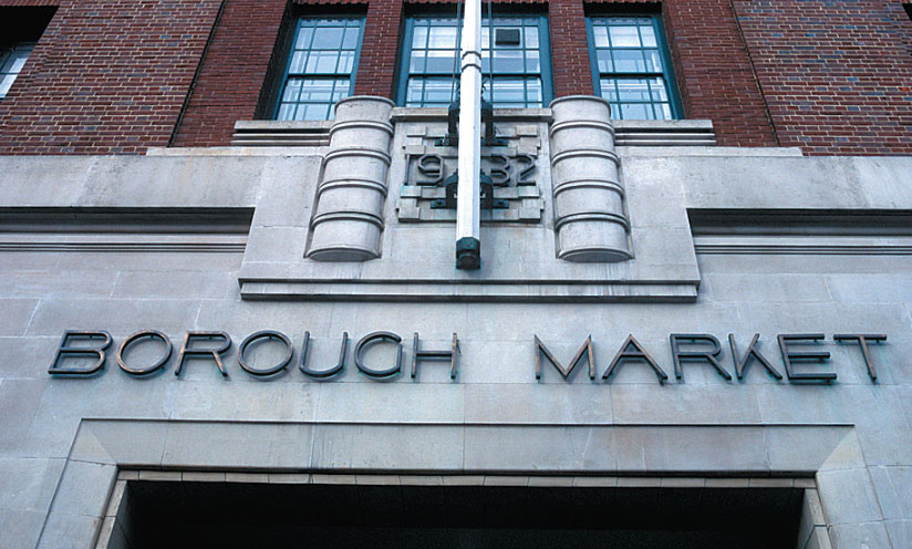
Borough Market, a farmer’s market since Roman times, is now a giant boutique of fine foods from around the world, catering to retail customers as well its wholesale clients. While cod and cauliflower are still sold by the ton in the early mornings to supply London’s restaurants and supermarkets, tourists dominate in the daytime, and local residents peruse stalls offering free-range British beef, Italian cheeses and Spanish paella. The grocers have gone gourmet.
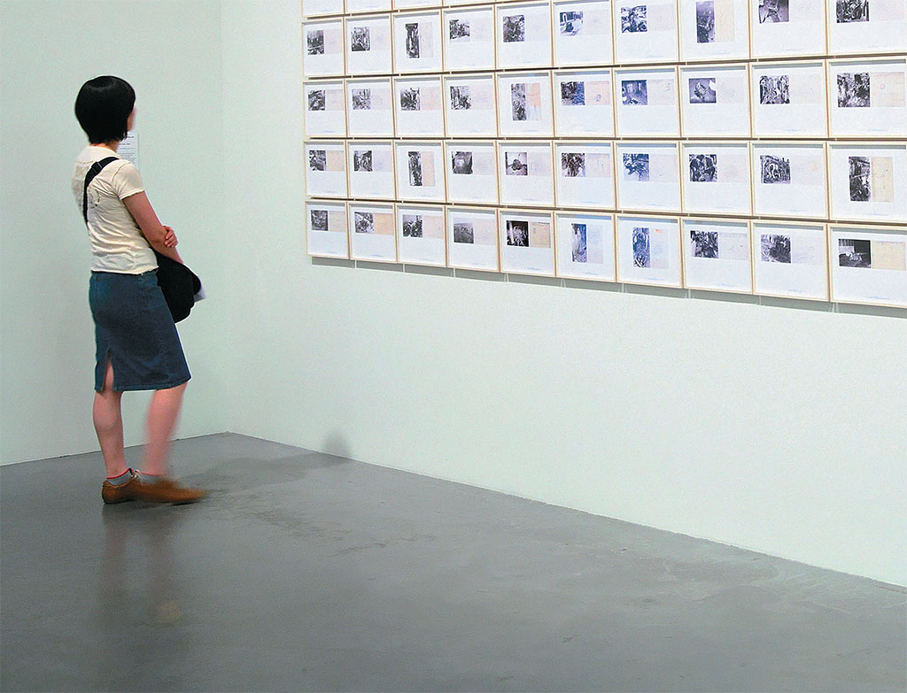
Tony Blair’s government added its own touches with an ambitious building project to celebrate the new millennium. The old Bankside Power Station was converted into the Tate Modern, one of the world’s largest museums of modern art. Workers removed the building’s heavy machinery and divided the upper levels into floors, but left the main turbine hall open, providing a vast space that’s challenged a steady succession of artists to fill it with massive installation pieces. The exterior remains much as it was, an imposing monolith of brick, although smoke no longer emerges from its towering chimney to float across the Thames and sully the white dome of St. Paul’s.
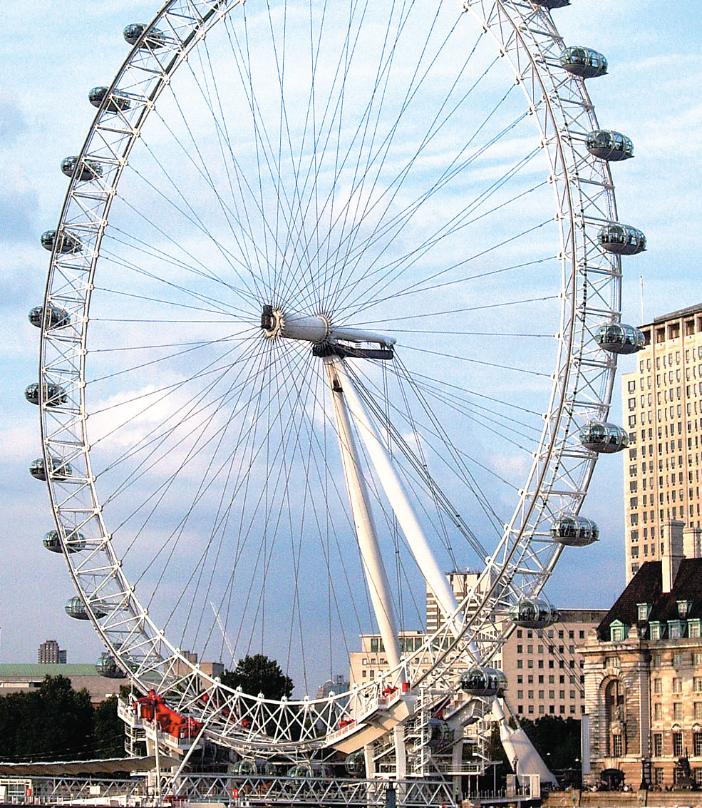
ANOTHER PROJECT along the central London portion of the Thames Path, the Millennium Wheel, draws even more visitors than the Tate Modern. Also known as the London Eye, this giant Ferris wheel carries visitors 443 feet above the river for a stunning view of the city. While at first many Londoners complained that the Wheel was an eyesore, it is now accepted as part of the London city skyline and attracts an average of 10,000 visitors a day, making it the most popular fee-charging attraction in the country. The crowds stop to shop and eat at the old County Hall, which now houses a hotel, restaurants, stores and an entertainment center, complete with video games for the kids and a bar for the parents.
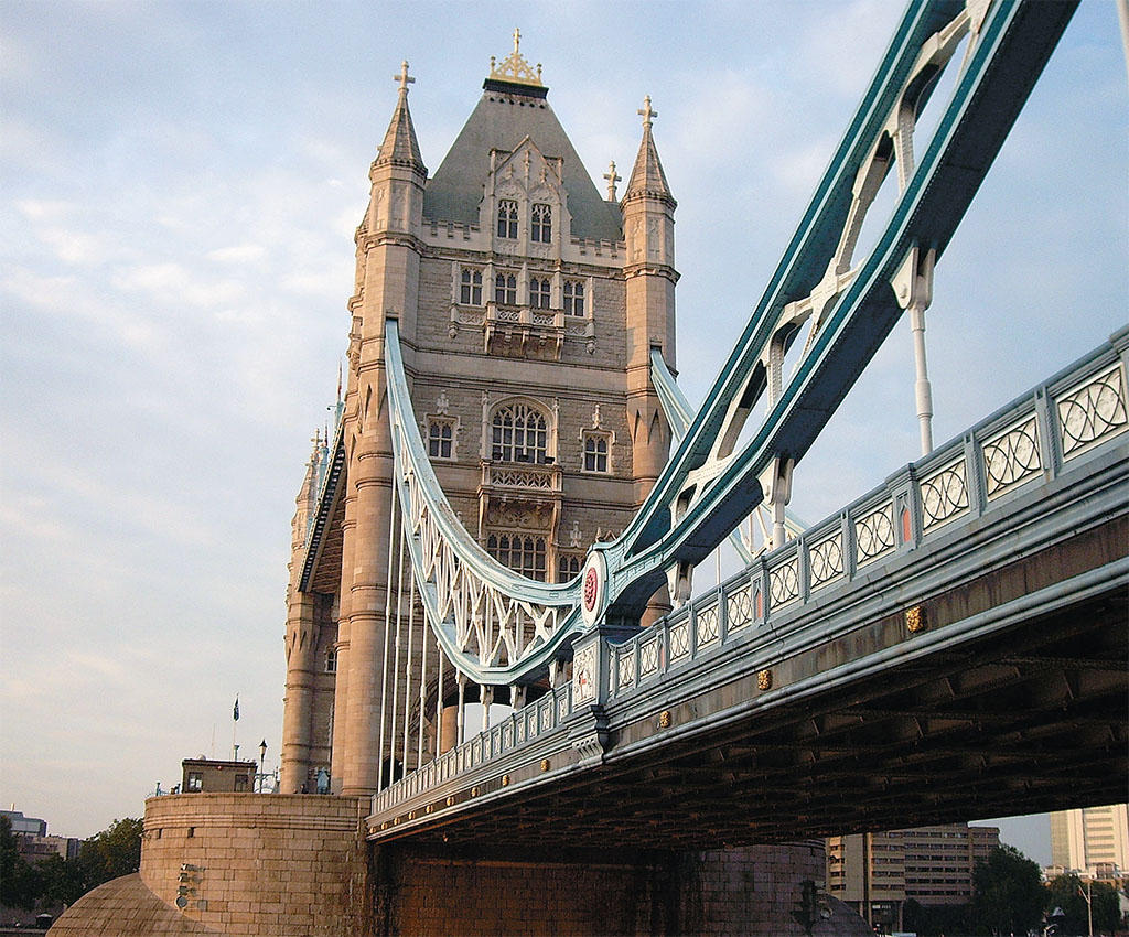
The Tate Modern and the London Eye are only part of the contribution the Thames Path has made to London’s tourist industry. The most popular portion of the path starts at Westminster Bridge, next to the Houses of Parliament and Big Ben, and extends three miles east to Tower Bridge, next to the Tower of London. In between are dozens of popular sites including the London Aquarium, Royal National Theatre, the Globe, Southwark Cathedral and HMS Belfast. For those who don’t want to walk, several London Underground stations are nearby, and boats regularly make runs between several piers along the way.
[caption id="TheThamesPath_img1" align="aligncenter" width="1024"]
SEAN MCLACHLAN
Even the shortest walk around London, though, should include the Millennium Bridge. A stunning glass and steel expanse linking the Tate Modern on the South Bank to St. Paul’s on the north, it is one of the main pedestrian thoroughfares in the city. From its center you can see the imposing brick edifice of the old Bankside Power Station on one side, its massive smoke tower serving as a strange counterpoint to the graceful 17th-century baroque dome of St. Paul’s on the other, and the glittering River Thames below.
To the west the ribbon of water curves by the historic center of London, with its church spires and stately old buildings. To the east stretches the new city, the gleaming office towers of Canary Wharf, where docks have been replaced with high rises and the endless rows of warehouses-turned-apartments.
‘VISITORS AND INVESTMENT POUR IN ALONG THE THAMES PATH’
This is London as it has always been, with history and change existing side by side, developing on top of itself in a constant state of flux that nevertheless echoes the city’s immutable spirit.
While most people end their walk at Tower Bridge, a group of investors wants to change that. A project called More London has built a series of office blocks and opened The Scoop, a sunken amphitheater right next to the Thames Path, where every summer both famous and emerging British actors perform a series of classic and contemporary plays. Nearby is Hay’s Wharf, now converted into a shopping center covered by a beautiful Victorian ironwork arch.
More London is drawing an increasing number of visitors east of Tower Bridge, where they find the Design Museum, and beyond that a pleasant walk along the Victorian waterfront. Tireless walkers can continue a mile and a half to the Mayflower, a charming old pub of oaken beams with a sweeping riverfront view. The name comes from the wharf that stood on the location, whence the famous ship of the same name sailed off to the New World.
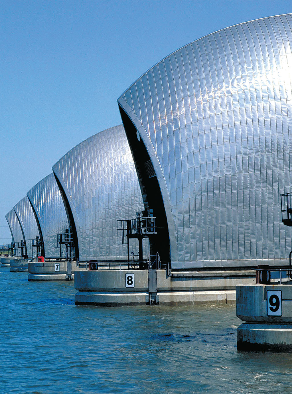
Even at its farthest reaches, in the distant Charlton suburb by the Thames Barrier, the path has helped rejuvenate the local area. The London Development Agency has opened a verdant 22-acre park with fine views of the futuristic-looking flood barrier. The park, built on what used to be desolate, abandoned industrial land, now attracts thousands of visitors every year.
As the visitors and investment continue to pour in, city planners from all of London’s South Bank boroughs bordering the river agree that the Thames Path has been a major boost to the local economy. London no longer has a “wrong side of the river.”
[caption id="TheThamesPath_img2" align="aligncenter" width="1024"]
BRITAINONVIEW
[caption id="TheThamesPath_img3" align="aligncenter" width="824"]
BRITAINONVIEW
[caption id="TheThamesPath_img4" align="aligncenter" width="985"]

BRITAINONVIEW
[caption id="TheThamesPath_img4" align="aligncenter" width="985"]
SEAN MCLACHLAN (2)


Comments