The Highland RoadGetty: Images
Join Jim Hargan as he takes a trip through the Highland Road.
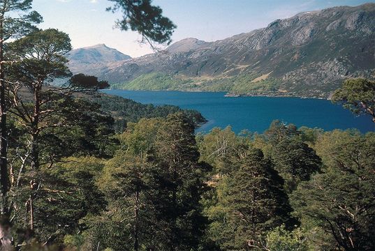
It’s the single most magnificent long drive I’ve ever experienced, on any continent—well over 300 miles of mountains rising straight up from an aquamarine sea, with serene lochs, quaint villages, waterfalls, seaside cliffs, comfy little hotels with friendly bars and vast stretches of empty heather moor.
Even better, this drive along Scotland’s northwest coast never takes you past a billboard, or a shopping plaza or even a supermarket. (Although, to be fair, it will take you past a three-aisle Spar store in an old croft barn that calls itself a “supermarket.”) This is not, however, a groomed parkway for tourists; it is the ordinary main road of the region, the one people use in their daily routine.
Read more
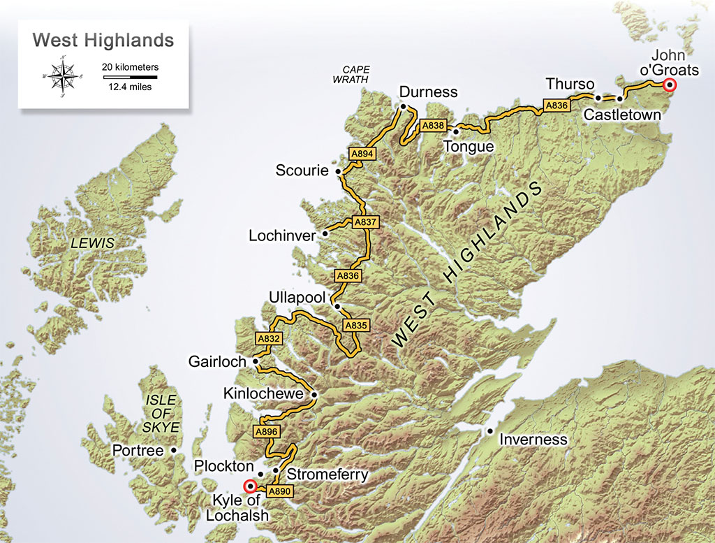
Starting at Kyle of Lochalsh, primary “A” roads closely follow Scotland’s western and northern coast, coming to an end at John O’ Groats 300 miles later. It’s all the same road, actually; at any intersection, you always turn towards the coast, either left or straight. The most remarkable feature, apart from continuously gorgeous scenery, is its isolation, going as far as 60 miles at a time with no visible links to the outside world. Its second most remarkable feature is that much of it is only one lane wide, and you pass oncoming vehicles using pull-outs. This makes it little better than the few back roads of the region, and good reasons to stray should be taken up. Our drive will include three back-road excursions. Because of the road quality the Highland Road cannot be completed in a day, and two days is pressing it. I’ll describe a three day journey.
You’ll start from Kyle on back roads, taking Main Street north from town center signposted to Plockton. Once clearing Kyle (it won’t take long), you will get a brief look at typically impressive Highland coastal scenery, as you cut through high moors with views towards the sea. Then, three miles into the drive, you will suddenly drop into scenery unusual in the Highlands: lovely pastoral countryside, with quaint villages built of whitewashed stone snuggled into rich, well-kept fields. Plockton, justly famous for its beauty, nestles by the sea, its bright stone cottages lining a 2,000-foot harbor with fishing boats bobbing in the water and mountains rising on the far side. Back in 1996–98, the BBC shot its series, Hamish Macbeth, entirely on location here.
This oasis of rural prettiness was brought about by the same forces that led to the vast emptiness that you will experience the rest of the way to Duncansby Head. By the end of the 18th century, Highland clan chiefs had largely transformed themselves into Anglophone lairds, aristocrats who now looked down on their Gaelic-speaking clansmen as savages whose primitive agriculture couldn’t support their lairds in the English aristocratic style.
A few lairds approached this in a humane and systematic way, and the Plockton area is one example of how well this humane treatment could turn out. Mostly, though, the lairds just expelled their people from their lands in a cruel disaster known as The Clearances, forcing them to choose between exile or a barren coastal “croft” of two to six acres, where they would teach themselves how to survive. Generally, they grew potatoes. The side lanes to your left, toward the sea, invariably dead-end at these crofting communities, even less populated now than back then.
GREGORY PROCH
From Plockton (Signpost: Stromeferry, then Dingwall), after 10 miles, pick up the A890, signposted to Strathcarron. From here the coastal scenery becomes more wild and desolate. You are on your first long stretch, 30 miles with only one major intersection (A896, signpost: Strathcarron). You’ll pass Attadale Garden, whose 20 acres surround a classic Scottish manor, seat of the Clan Matheson—the laird who humanely improved the Plockton lands and went bankrupt for his pains. After that, you’ll round your first sea loch and pass through the attractive village of Strathcarron.
Now you’ve reached a little side road on your left (signpost: Applecross), and your biggest decision. Do you stay with the A896, a rough, single track that passes through the heart of the mountains in deep defiles? Or do you go over the mountains at one of their steepest and most rugged points, traveling 27 miles out of your way on the justly infamous Applecross Road? Of course, you take Applecross Road, and climb straight up cliffs on a twisting single track with 20 percent gradients. Any passengers, should they open their eyes, will be rewarded by incredible views of the road twisting far below. More road fun awaits as you sink more than 2,000 feet in elevation to the seashore at tiny Applecross village. The pub is a short distance to your left, in a low, stone building by the sea. A lovely jaunt along sea cliffs in the opposite direction leads back to the A896 (signpost: Kinlochewe).
For the next eight miles, follow Loch Torridon, lined by mountains that boast razor-edged peaks like the Alps. Reaching Kinlochewe, turn left onto the A832 (signpost: Ullapool) and follow the shore of one of Scotland’s loveliest freshwater lochs, Loch Maree, passing through an ancient Caledonian pine forest, one of the oldest forests in Britain. In 2.6 miles, there’s a trailhead parking lot, where a loop path climbs up through the forest to a craggy viewpoint.
You are now driving on the Destitution Road, created in 1846 to provide work for crofters devastated by the Potato Famine; no through roads will intersect it for the next 60 miles. Up ahead is the village of Gairloch, whose four hotels make it an excellent place to stop for the night. There’s a good reason to hang around Gairloch for a few hours the next morning; the finest garden in the Highlands, Inverewe, is just six miles away and doesn’t open until 10. Bide your time with a walk up Flowerdale Glen to a waterfall, past the mansion where the MacKenzie lairds continue to maintain their seat.
Back on the road, Inverewe Gardens is just beyond the lovely little village of Poolewe, notable for its waterfall directly under the A832 bridge. When Osgood MacKenzie, a younger son of the 12th laird of Gairloch, purchased Inverewe in 1862 he found it a dreary and abused place, blasted with salt spray from Loch Ewe, its soils reduced to peat bog and bare rock. He set about restoring it, importing soil from Ireland as ship’s ballast, and searching the world for species that would stand the harsh salt-saturated environment. In doing so he created 100 acres of subtropical gardens and forests, noted especially for its displays of azaleas and rhododendrons, one of the most famed gardens in Britain.
The Destitution Road ends at the A835, signposted to Ullapool, reaching that town in 12 miles. With 1,300 residents, Ullapool is the largest Highland town along your route, and is the major ferry port to the Outer Hebrides. It’s a handsome place with stone cottages lining its waterfront, noted for its ceilidhs. Here you’ll find a choice of restaurants and pubs, and local crafts.
Continue on the A835; your signpost is now Lochinver. Ten miles from Ullapool, turn left onto the third and final back road jaunt, signposted to Achtibuie. After two miles the road reaches the banks of freshwater Loch Lurgainn and follows it for six miles, with continuous stunning views. This is part of the great Inverpolly Nature Reserve, the center of a region noted for its strangely formed mountains. In five miles from the A835, a well-marked path leads to the top of one of the oddest and most spectacular of these, Stac Pollaidh, a one-mile slog at 30 percent grade. Up here you can admire the sandstone “stack” that forms its mesa-like peak, its sides carved into strange pinnacles. Views are wide and remarkable.
JIM HARGAN
Almost nine miles from the A835, turn right at the first intersection, signposted to Lochinver; in another six miles, you’ll reach the sea—with yet more stunning views. In 8.5 miles from the intersection, a streamside picnic area begins a two-mile trail to the Falls of Kirkaig, a wide and strong torrent over sheer black rock. Walk another half mile to the shores of Fionn Loch for the best views toward Suilven, the strangest of the Inverpolly mountains. Suilven looks not so much like a natural feature as a fortress from Mordor, built for some evil purpose beyond the ken of mankind. From here a sturdy hill walker can circle it from its far side and conquer its peak with no more equipment than a hiker’s staff.
In three more miles, you’ll reach the seaside village of Lochinver and the A837. For two miles Lochinver stretches and straddles along a pretty little cove, with several hotels and restaurants—a good place to spend the night. If you’ve taken any of the hill walks, it’s probably getting late; but if you want to press on, your next hotel is at Kylescu, in 18 miles.
The final day’s drive features mile after mile of striking scenery. It’s all remarkable, but there is so much of it, so unbroken by habitation, that it overwhelms. Start by following the A837 eastward out of the village. Drive for 10 miles without intersection—six of them along the banks of stunning Loch Assynt—to a left onto A894, signposted to Durness. As you turn, note the romantically ruinous Ardveck Castle on a little promontory, only a half-mile out of your way and worth a visit. As you continue, the strange mountain on the left is Quinag, the last of the odd sandstone peaks of Lochinver; the only signs of settlement are tiny Kylescu, and slightlys larger Scourie with its two beaches. After 24 miles the road number changes to A838, signposted to John O’ Groats, but the pattern continues, with long stretches of magnificent wildness punctuated by tiny villages. In 19 more miles you reach Durness on the north coast of Scotland, a plain little place.
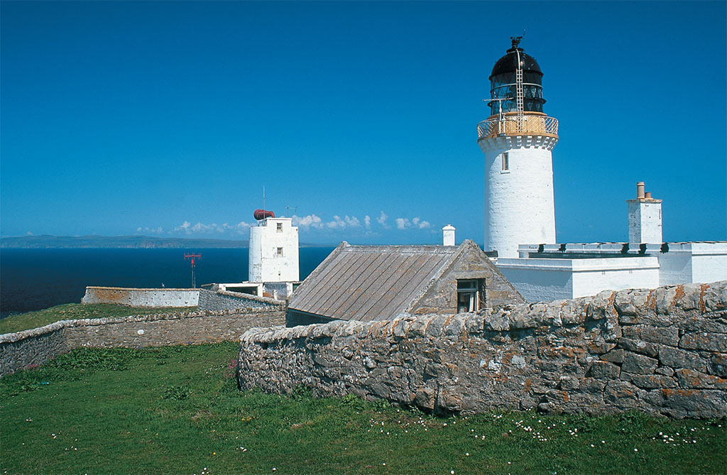
To the east of town is Smoo Cave, a sea cave whose immense entrance arches over a shingle beach, with a boardwalk deep into its interior, part of it a tiny free park. To the town’s west is the first of the great sea cliffs along this route, at the appropriately named Cape Wrath. With its 1828 lighthouse, tiny tea room and 500-foot cliffs, Cape Wrath is a worthy but time-consuming destination; to get there you must take a passenger ferry across the Kyle of Durness, then a minibus for an 11-mile ride to the cape.
You have now turned along the north coast of Scotland. Even the crofting settlements have vanished; look for abandoned piers and lime kilns, evidence of continuing desertion since The Clearances. For miles to come, the empty mountain landscapes will alternate with sea views, sometimes over long sea lochs, sometimes over cliffs that shelter beaches. Those beaches! Thick, pure sand, of a light gold that approaches white, wide and clean and piercingly clear turquoise water. Wild beaches, little visited, are easily reached from the highway, and a map and cliff-walk will take you to your own deserted strand, washed by the clear, cold waters of the North Sea.
In 30 miles you reach a scenic highlight, the causeway over the Kyle of Tongue with wide views. On the far side is the village of Tongue, tree-shaded and well kept, with two excellent hotels, both good places to eat. Beyond Tongue the emptiness slowly diminishes, apparent from the gradual reappearance of side lanes leading left to coastal crofts. Twenty-five miles from Tongue village a small sign directs you to Melvich Beach, spectacular even by Highland Road standards. Three miles after that, you have left the mountains.
JIM HARGAN
* Originally published in 2018.



Comments