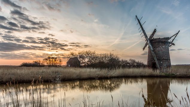
The Fens: Brograve mill at sunset in Norfolk.Getty
They're one of Britain's most unique landscapes and provide plenty of challenges for locals, what it's really like to explore the Fens.
As it turned out, Britain was pretty awful during the last Ice Age, and people avoided it; mile-thick ice caps had something to do with it. When people did start appearing about 100 centuries ago, sea levels were still 150 feet below the present level, and the new settlers simply walked over from Europe; the Dover-Calais ferries now float high above their paths.
A lot of water has covered a lot of land since then, disrupting human societies and natural ecosystems all the way. Nearly every continent has a low-lying stretch of coast that has been affected. The United States has several: Georgia’s Sea Islands, the Florida Everglades, and Louisiana’s Mississippi Delta. In England, the largest such area is called the Fens, 300,000 acres of flat and sinking land, facing the North Sea from Cambridge to Lincoln. The Fens, like the Louisiana Delta, formed over the last 10 millennia as rivers dumped sediment onto a sinking plain, forming wide marshes.
A person might see one of these marshes as something eternal and unchanging, but this appearance is erroneous; in geological terms, these lands are recent and changing rapidly. A person might also think he’s looking at ordinary land that’s been flooded. This, too, turns out to be a serious, common and costly error.
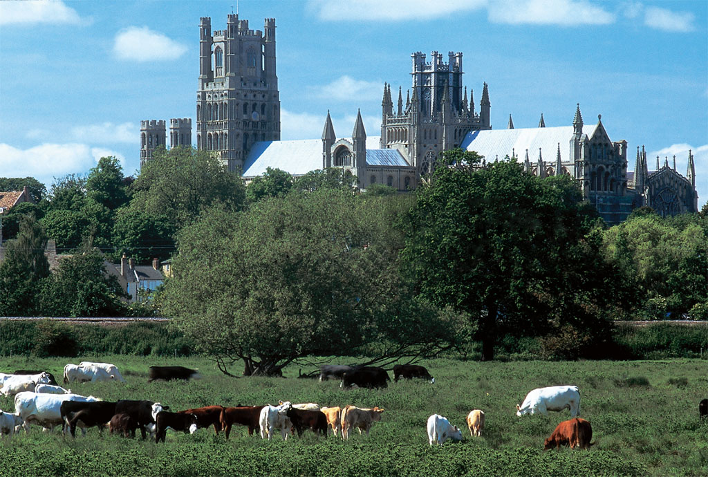

Contented cattle graze in water meadows in the shadow of Ely Cathedral. Known as the “ship of the Fens,” the cathedral began as a monastery founded by St. Ethelreda in AD 673 Image: JIM HARGAN
Let’s start with these errors
Daniel Defoe called the Fens “the sink of thirteen counties,” meaning that rivers drained most of Middle England into these low, flatlands. In the spring, these rivers would run in high floods, heavy with sediment. When they hit the flat Fens, they would slow down and drop the heaviest of their sediment load. These sand and clay bars would obstruct the channels and send the rivers into wide meandering patterns, perhaps doubling their length before they hit the North Sea in the Wash, a large shallow bay. Of course, the longer a river took to fall to the sea, the slower its water, and the more sediment it dropped.
This left the Fens with a shifting landscape of sluggish channels choked by sediment banks both new and ancient. In between these clogs, standing water would foster rich marsh vegetation. This, in turn, caused the formation of peat, nearly pure plant material partially rotted to a brownish-black mass, with the rotting halted by lack of oxygen in the standing water.
Peat, unlike normal vegetation, will never rot as long as it stays in standing water; over eons, it will turn into coal instead. Moreover, peat will accumulate at a remarkable rate - a foot or two in a decade. Dried peat forms into burnable bricks (it smells like Scotch whisky when it burns), and because it accumulates so rapidly, a small village can stay in equilibrium with its peat fuel supply over many centuries.
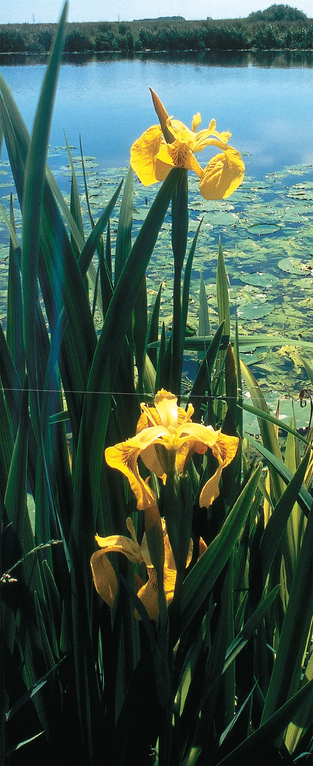
Yellow flag iris bloom in the water meadows of the River Great Ouse, flooded as a wildlife reserve Image: JIM HARGAN
For the last 60 centuries, sea levels have risen gradually and slowly, an oddity in a geological record otherwise filled with large sea-level oscillations. Even so, the North Sea had a nasty little jump between AD 350 and 550, flooding the coasts of northern Europe with an extra 2 feet of water and sending its inhabitants - folk known as Angles and Saxons - fleeing (although “conquering” might be the better word) into ill-prepared Roman territories.
At the start of this rise, the areas we know as the Fens were a well-settled part of Roman Britain ruled from the town of Duroliponte (Cambridge) by its native people, the Christianized Romano-Celtic Iceni. Then the sea level rose, and history’s curtain went down for two centuries.
When the curtain came back up, Duroliponte and the Iceni had disappeared, and 300,000 acres of marshlands covered the northwestern flank of the pagan German kingdom of East Anglia. The modern Fens had come into existence.
The modern Fen
Now it’s time to take on one last error: that the undrained Fens were empty wastelands of little or no economic use. This was certainly untrue by medieval times and was probably never true. Left alone, the Fens grow over with a dense, brushy scrub vegetation known locally as carr.
It seems, however, that medieval Fenland vegetation consisted of vast beds of sedge and reed, with willow and grasslands in the drier spots and ponds in the wetter spots. These ecosystems are not natural; they are human-induced and must be harvested regularly to avoid the transition to carr. People were in the Fens from the start, exploiting the resources and shaping the environment.
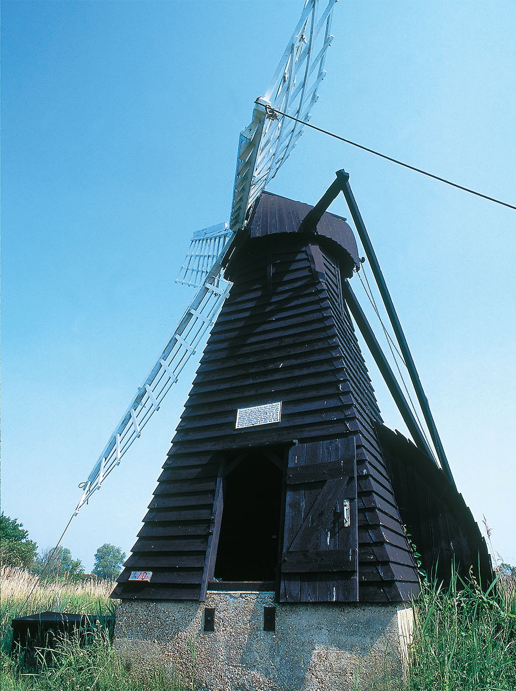
Wind-driven pumps proved an ineffective means of draining the vast wetlands. The last surviving windmill pump in working order operates at the National Trust’s preserve of Wicken Fen just northeast of Cambridge Image: JIM HARGAN
The Fenmen were a tough breed - stubbornly independent of the aristocracy, known to keep to themselves and resent outsiders. They found a good living, made better by tax avoidance, by fishing, catching waterfowl, trapping eels, coppicing willows, and other marsh trees, making baskets, taking peat for fuel, and harvesting sedge and reeds. The sedge and reed harvests were economically important as high-quality thatch for roofs and were ecologically important for maintaining the Fens’ open character and abundant wildlife. Peat harvest was important in the same way, and the peat beds were left to restore themselves. In all, the Fens probably pumped as much net value into the medieval economy as the same amount of farmland.
The Church owned nearly all of the Fens in this period, through a series of abbeys, monasteries and “colleges” (clerkly monasteries, with several rich ones in nearby Cambridge). Early monks liked the Fens for their solitude and set up a series of abbeys and monasteries on clay islands that rose above the general marsh. They were rewarded for their piety; wealth flowed from the Fens’ hidden resources into these abbeys. The religious foundations seem to have understood the Fens’ peculiar economy and maintained good relations with the Fenmen. They exploited the Fens’ wealth cautiously, expanding pasture and crops by drainage were convenient but making few systematic efforts. They probably knew better.
The greatest of these foundations was at Ely (from Eel Island), a 70-foot hill of clay deposited on a limestone outcrop, a veritable mountain rising from the Fens. Founded as a monastery in 673, Ely became a cathedral in 1109. The massive cathedral sits like a crown around the hilltop, with the town climbing down its slopes to a delightful small quay on the River Great Ouse (pronounced, fittingly enough, ooze). Ely remains and thrives to this day, and its 14 centuries of history sit kindly upon it. The Fens’ other religious houses were less lucky, and few show even scant ruins above ground.
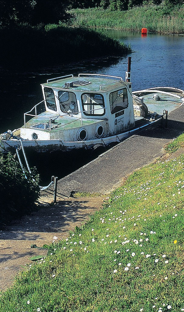
For centuries the Fenmen have drawn a comfortable living from the waters and the wetlands of the Fens Image: JIM HARGAN
With the Reformation, Henry VIII seized the great Fen foundations and gave their property to his pals and supporters—none of whom actually lived in, or knew anything about, the Fens. While the monks knew how to keep the Fenmen happy and the tithes flowing, the new owners did not. They seem to have assumed that the Fens were economically barren and didn’t notice that their Fenmen tenants had declared a permanent tax holiday. Truth be told, it took a brave and foolish man to enter the Fens with the intent of collecting money from Fenmen. This happy state for the Fenmen lasted for 100 years.
It was Charles I who broke up the party. His continuous struggles with Parliament - which eventually led to his execution - left him strapped for cash, and he wanted to put an end to the Fens’ duty-free zone. In 1630 the king granted the fourth Earl of Bedford the right to drain 95,000 acres traversed by the Rivers Nene and Great Ouse, stretching from Ely well to the north. Bedford, along with 13 fellow investors known as the Gentlemen Adventurers, hired the Dutch engineer Cornelius Vermuyden to work on the project from 1630 to 1655, with time off for civil war.
Stretching from Cambridge to Lincoln, Peterborough to King’s Lynn, the Fens encompass almost a million acres of man-made landscape, rich with dark topsoil and a labyrinth of tranquil waterways abundant in wildlife Image: JIM HARGAN
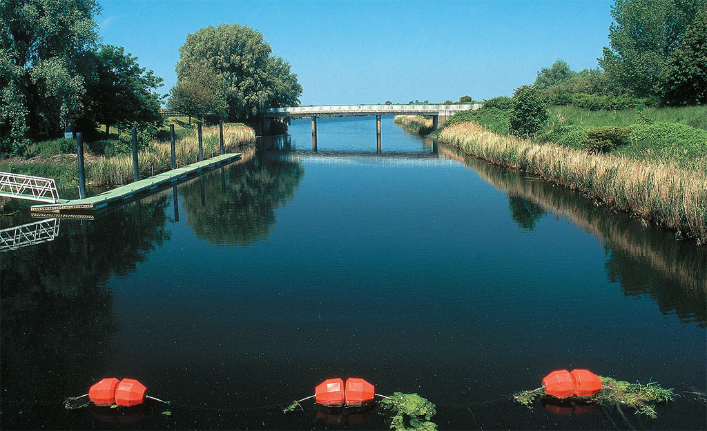
Vermuyden understood that the flooding rivers clogged the Fens with deposits and set about fixing that by straightening their channels. A straightened river would rush its flood-waters right past the Fenlands, scour its channel and dump its sediment harmlessly into the Wash. In the largest of many projects, Vermuyden diverted the Great Ouse into two parallel channels running straight as a ruler—an amazing flood control structure 20 miles long and 1 mile wide. When floods became too great for the two channels, the mile space between them would store the excess waters. At the end of their 20-mile run, the channels intersected and rejoined the Ouse at the start of tidal waters, where a sluice could hold them back at high tide and release them at low tide to scour the channel.
This part of Vermuyden’s scheme worked - and continues to work, although Vermuyden’s original sluice collapsed after 50 years and had to be rebuilt. Vermuyden, however, assumed that the local fields could be easily drained into this and similar channels by gravity. In this, he was mistaken, even though the black, water-logged “soil” of his era was high enough. That wasn’t soil, though, it was peat. It had built up, as it always does, and would rot away as soon as it was drained and exposed to air. Within a few decades, the fields had sunk below Vermuyden’s drains. By the early 18th century, the Fens were once again flooded.
While the methods and tools have changed over the years, from early medieval times the Fens have been a managed landscape and ecosystem Image: JIM HARGAN
Landowners were in a bind. They had spent vast sums on drainage and had enjoyed a tantalizingly brief period of high agricultural returns. To fix things, they paid increasingly high property taxes to support the drains, and they purchased “wind engines” to pump their excess water uphill into them. This didn’t do the trick; windmills were a lousy pumping technology.
A single windmill pump cost a mammoth £800 to £1,500 to build ($75,000 to $150,000 in 2006 dollars) and required a full-time staff of two to operate. One windmill could only raise water about 6 feet, so several of them might be needed in series to get the water up to the drain. While a big windmill could produce a respectable 40 hp, it worked only in winds between 18 and 24 mph. During a really bad flood, the water in the drain could rise above the top of the windmill’s scoop wheel, rendering it useless. In the 18th century’s wet, cold winters, a frozen millrace would stop a mill’s scoop wheel from turning.
They coped. Fen owners settled into a system where only a third of the land would be drained and cultivated, while two-thirds were seasonally flooded for grazing. The land was brought into cultivation by “paring and burning” - that is, plowing lightly, then burning the aerated peat to sweeten the acidic peat underneath. The burnt-away peat greatly lowered the ground level, so that the field could only be kept under the plow for four to six years before it became too low for the windmills. Then the field would be allowed to flood again - and the peat would build-up to its old level. It wasn’t a great system, but it worked. By 1800, 90 percent of the Fens was under this sort of rotation.
By the 1840s, steam engines had become small and cheap enough to replace the windmills—and this allowed, for the first time, Vermuyden’s dream of permanent drainage. Within 30 years, windmills and marshes virtually disappeared from the Fens; only one of each exists today. The tiny remaining windmill drained remote Adventurer’s Fen until the early 20th century, when England’s national preservation charity, the National Trust, bought it and all the surrounding land. That surrounding land, Wicken Fen, is now the only surviving Fen marsh and the single place where you can see how the Fens appeared before steam, with its windmill still in operation.
With modern engines, the Fen owners had all they needed to systematically drain the Fens, except for a system. Literally hundreds of commissions, authorities, councils, and boards held the Fens in a chaos of jurisdictions that taxed, regulated, built, fined, overlapped, competed, provided sinecures, stoked egos, protected turf and built empires. Planning didn’t even make the top 10. All too often, an authority would “solve” a problem by dumping its unwanted water into the territory of someone else—who would, of course, make no allowance for it.
So the Fens were drained permanently, except when they were covered by disastrous floods. Typically, floods would come suddenly as a sluice or a bank failed during a major event, releasing a great surge of water onto downstream structures too weak to take it. The entire nonsystem could pancake in a few hours. When a failure of this sort occurred, church bells would ring to alert the folk of danger; the church itself, invariably on high ground, would serve as the evacuation shelter.
After World War I, they tried to use air raid sirens, only to find the electricity failed before the sluices, and bells continued to ring out warnings as late as 1947.
Things finally got serious when, on January 31, 1953, a North Sea gale flooded drained lands from England to Holland, killing 307 people in the Fens and more than 2,000 in the Netherlands. While the English response was less dramatic (and less effective) than the Dutch, the Fens have now been comprehensively planned and bristle with big, new flood-control works. In the Fens, nature has at last been conquered.
Few landscapes exist in the world today that do not show the hallmarks of human meddling and ingenuity, and the Fens are no exception. The reclamation of hundreds of thousands of acres has been an ongoing project since the Middle Ages. While civil engineering has created vast expanses of rich farmland, however, it would be overconfident indeed to claim that the Fens have been tamed or stabilized.[/caption]
Except it hasn’t. The planners had once again forgotten about peat. Before steam engines, Fen farmers allowed the peat to accumulate on a rough but reliable cycle. That stopped by 1870. Now all the peat, everywhere in the Fens, evaporates every day of every year. When Vermuyden started in 1630, he thought he could easily drain the Ely area by gravity. Today, the zero contour line—sea level—extends past Ely, 30 miles inland. Every year these lands sink farther as they lose more peat.
As the peat sinks, the sea level rises - another foot since the Dark Ages’ 2-foot jump. During the 20th century, ocean levels jumped an additional 3 or 4 inches - not much even by geological standards, but a strong acceleration from preceding centuries. Global warming believers think they know the reason for this and predict that the next century will see 1 or 2 feet of sea-level rise. Be that as it may, the geological record clearly shows that we are in an upward trend, that we have another 20 feet to go to reach a normal interglacial maximum and that a yard rise in a century is by no means odd.
The Fens are not unique or unusual in having these troubles. These types of problems happen wherever people have tried to block the rising sea while building on sinking peat - even here.
* Originally published in 2007.


Comments